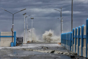
The areas of the Visayas and Mindanao are likely to be hit by one to two tropical cyclones this December, according to the Philippine Atmospheric, Geophysical and Astronomical Services Administration (PAGASA).
In its Monday advisory, PAGASA said the presence of a high-pressure area in the northern part of the country — which typically forms around December — is pushing down the trajectory of storms, making the Visayas and Mindanao more likely to be affected.
The next tropical cyclone will be named “Wilma,” the country’s 24th tropical cyclone this year.
If officially declared, PAGASA said it would mark the first time the country has reached the letter “W” in its cyclone naming list since 2013, the same year Super Typhoon Haiyan, locally known as Yolanda, formed and devastated large parts of the Visayas.
Meanwhile, PAGASA is monitoring a cloud cluster located east of the Philippine Area of Responsibility (PAR). It said the system is likely to enter PAR and may develop into a low-pressure area (LPA) in the next few days.
The system is likely to cross the Caraga Region, Visayas, and Southern Luzon, with a low to moderate chance of developing into a tropical cyclone, PAGASA said in a separate tropical cyclone threat potential outlook.
Although no tropical cyclones are directly affecting the country during the forecast period, PAGASA said large parts of the Philippines are likely to experience cloudy skies, rain showers, and thunderstorms during the first week of the month.
Mostly cloudy skies with scattered and isolated rains are expected over Cagayan, Apayao, and Ilocos Norte until Wednesday. Similar conditions are expected in the rest of the country due to the easterlies.
From Thursday to Friday, the trough of the said low-pressure system is likely to bring mostly cloudy skies with scattered rains and isolated thunderstorms in the Bicol Region, Eastern Visayas, Caraga, and Davao Oriental.
PAGASA advised the public to regularly monitor its advisories for any significant changes in the forecast. — Edg Adrian A. Eva

